 |
1880 Highway One - Bodega Bay - 20 Acre Estate Parcel
Site Prep and Information
|
Most linked PDF files in the text below will provide you with much greater detail if you zoom in using the Adobe Acrobat Reader zoom feature. In particular any one of the files that was converted from a CAD drawing or a text file, will allow for almost infinite zooming and panning while those with graphics or made from scanned images may tend to show pixilation at some point. Also, the latest versions of Internet Explorer will allow for some zooming of all reference JPG graphic files.
A satellite photo of the 20+ acres of land being offered.
The Surveyor's final drawing that represents the survey of the property and the lot line adjustments with resulting acreages.
An email discussion/thread with Dave Hardy (planning Supervisor for the Sonoma Coast - 707-565-1924) regarding the direction for solving Caltrans Access, PG&E service and the solution to the wetlands requirements.
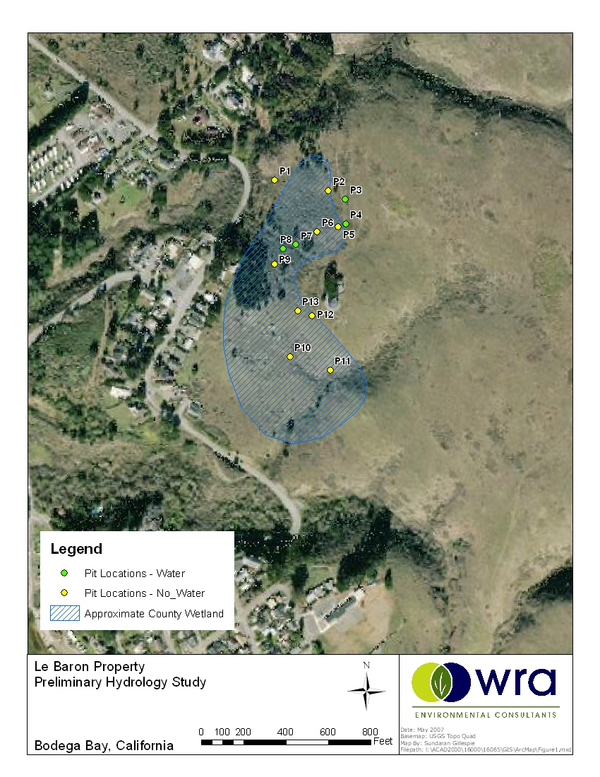
Doug Spicher (WRA Environmental Consultants, Inc.2169-G East Francisco Blvd. San Rafael, CA 94901 415-454-8868 ext. 126) elaborates on his investigations into the wetlands designation on the subject property - click here and here. An aerial map of the wetlands indicating the test locations as performed by WRA and the approximate extents of the County designation - be sure to zoom in for inspection. These tested wetlands locations are also referenced in this document (also provided by Doug Spicher of WRA) - these GPS coordinates are included in the lower right corner site plan and the references therein were converted to CAD and inserted by the surveyors during the Survey process - four wetlands locations were found and none appear to have any effect on planning to date. In addition, according to Doug Spicher, it is unlikely that wetlands would be found under the pine trees located down the hill and closer to Highway One and he was somewhat at a loss to explain the designation by the County. Discussions on this subject with Dave Hardy of PRMD, indicate that while there is the wetlands designation, use of specific portions of the land is only subject to testing by a biologist where the test results indicate that no wetlands habitat exists.
The percolation testing of the property included two locations, one (the upper) of which conflicts with the primary building site. The site plan includes the test locations for the lower area as inserted by the surveyors at the time of the Survey - the references were provided to the surveyors by Adobe Associates and the test results are available here. Adobe Associates subsequently proposed an agreement to provide the septic system design based upon those test results, in this case however, it would be premature to choose a septic field location prior to choosing an approved building site.
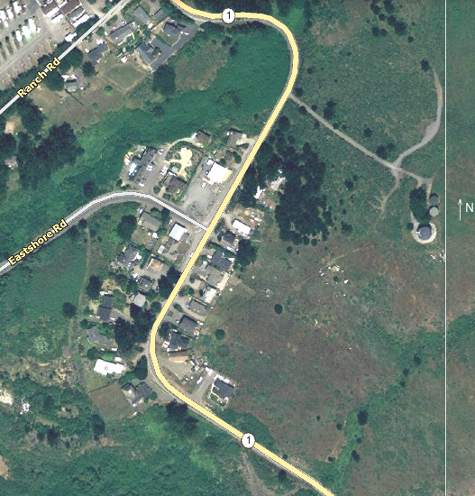
During the course of the Survey of the property, CAD drawings were prepared that will be necessary for an engineer to make the plan for Caltrans to approve an encroachment on Highway One. The surveyors (Phelps and Associates of Sebastopol - 707-829-0400) have agreed to provide the actual CAD drawings to the selected engineer when the time comes. Email discussions with Dave Dowdy of Caltrans have provided a preliminary positive finding on the location detailed in the above drawings - click here and here for those discussions. Dave Dowdy was also the recipient of the this drawing, which is a much more basic view of the plan and which calls for the retention of the existing driveway for the purpose of supporting water company access and water main easements - the drawing was attached to the early email from which the discussions originated.
This email discussion represents a preliminary discussion with Mike Chesharek (PG&E engineer for Bodega Bay - 579-6303) regarding the possibilities of power provided via the anticipated new Highway One encroachment. The upshot of this discussion and our brief onsite meeting was that there was little doubt that the route could be made to work.
This email discussion covers a conversation with a civil engineer one Stephen Bowser - quite a bit of work has been accomplished in this regard and contrary to the comments therein, the opening to the highway is now relatively clear of trees and brush. The latest conversation with the county regarding obtaining the encroachment permit from Caltrans requires that a Coastal Use Permit needs to be approved prior to the issuance of a new driveway encroachment. That task needs to be accomplished by the person(s) who have made the decision regarding what kind of and where a new home is going to be built - very personal choices.
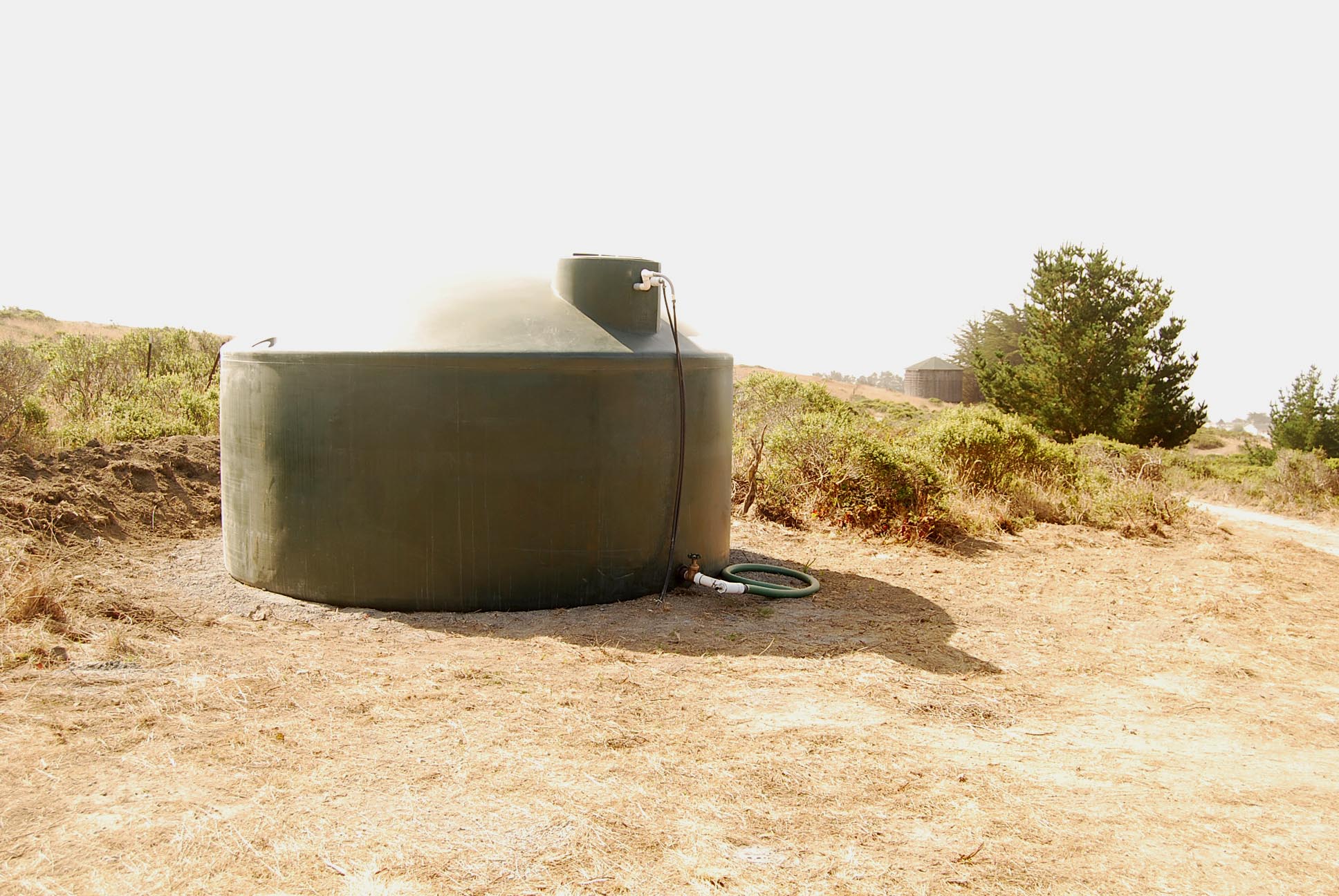
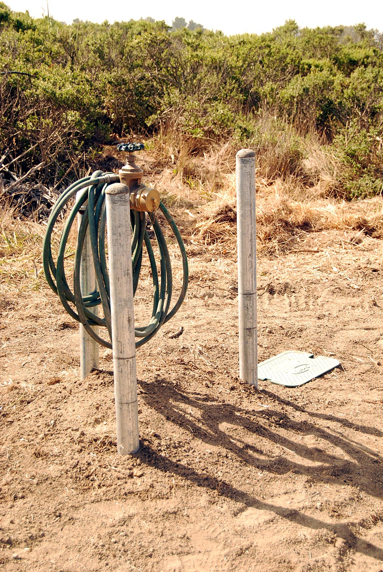
The requirements detail for well testing in Western Sonoma County and the results of the test conducted for the well that serves this parcel of land. The county will accept these test results for the purpose of obtaining a building permit during a period of three years beginning on the date of the test. The test results have not been filed with the county and may be filed at any time including in conjunction with the application for use and building permits. Click here for a photo of the 5000 gallon storage tank and here for the fire hydrant installed near the potential building site.
A potential floor plan with elevations (these plans were adapted from the plans of an existing coastal home not too far from Bodega Bay - photos are available), a possible site plan and a conceptual photo montage showing the rear elevation inserted into a photo of a potential building site. All referenced CAD drawings are available/included with the sale. In my conversation (reference above) with Dave Hardy we also discussed the removal of trees and his response was, "there are only two cases where there is concern by the county": one is if you plan to remove an entire stand of trees on a give parcel and the other is the removal of any tree which is part of a site plan and which is destined to provide some sort of mitigation relative to parcel development. This effectively gives one significant latitude when siting a home.
The site plan includes some references to exclusive easements and to two pending Lot Line Adjustments. The easements have been agreed to in order to expedite the conveyance of control of the locations to the neighbors and allow for them to convert the easement to ownership via a Lot Line Adjustment (see item number four) at some convenient future date. The pending Lot Line Adjustments are currently in a state of needing County approval and some discussion will be necessary regarding these two transactions.
Two panoramic photos of the heart of the quaint village of Bodega Bay and the surrounding unique vistas as taken from the approximate finished floor height of the conceptual home design - click here and here. From the left you will find Tomales Head, Point Reyes, the East jetty, Bodega Rock, Bodega Head, the jetty entrance, the complete channel, the ocean beyond the Head, the homes along Bay Flat Road and the Bodega Bay Marinas and the hundreds of boats neatly moored at the docks. Be sure to zoom in and pan completely to the left.
Value considerations and comparison to one local comparable:
Pristine and unique property unlike any
other - the last estate parcel in proximity to Bodega Bay harbor.
Protected from the wind and warmer than surrounding areas.
A multi-multimillion dollar view - heads above any other view anywhere - distant enough to
lend privacy and close enough to provide that feeling of being part of it.
Some development complete - the rest of the development has been addressed and seems
assured.
Recent boundary survey completed and currently being recorded.
Caltrans buyin seems negotiated - surveyor portion of new driveway/access is complete and
Surveyor prepared CAD drawings are included.
PRMD buyin seems negotiated - will allow new driveway and new utility pole to support
utilities installation - see email discussion.
PG&E buyin seems negotiated - see email discussion.
Well is certified (1.4 gallons per minute) and certification is valid through July 15,
2012.
5000 gallon water tank is in place.
Fire Hydrant is in place and working.
Water connection to likely home site is in place.
Newly surfaced road from well/tank site to home site installed.
Preliminary building plans with conceptual home placement photo montage included - helpful
for obtaining California Coastal Commission Use Permit.
All CAD drawings (Conceptual floor plan with front and rear elevations, drawing for
CALTRANS submittal survey, boundary survey/preliminary site plan) included.
CAD drawings include a GPS coordinates text file for most referenced points.
Comparison to 10 acres on Bay Flat Road (the only other acreage sold locally in recent
years).
| Taylor Hill is twice the size and has no steep embankments to complicate access. | |
| Bay Flat access is questionable. | |
| Bay Flat is totally undeveloped while Taylor Hill has a certified well, 5000 gallon water tank and fire hydrant. | |
| Taylor Hill view is assured. | |
| View on Bay Flat is, at best, marginal by comparison. | |
| Best view on Bay Flat may be constrained by action on the part of the owner of existing home to the Northeast. | |
| Bay Flat may need to use neighbor's driveway for access and may need to give up some view to get it. | |
| Bay Flat consists primarily of Sand Dunes which will create a myriad of mitigation issues not the least of which will be a more significantly expensive foundation. | |
| No PUD connection fees on Taylor Hill. | |
| No PUD extension development costs on Taylor Hill. | |
| No monthly water and sewer fees on Taylor Hill. | |
| Projects West of Highway One must meet a higher standard - on the
East side, the county acts as a liaison for the CCC, but on the West side, you must deal
directly with the CCC and the more stringent coastal permit process. |
Contact:
John Chute 707-540-5331 john.chute@gmail.com
ay coast coastal stunning view acres land water estate quality fishing village rare Coastal Estate Property stunning views of Bodega Harbor Pacific Ocean above sea level nestled protected